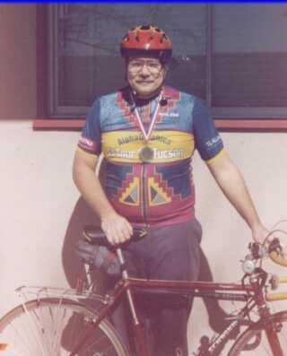
So I took Jamis.
I headed west, then north, past the stadium, and then further north, and then FURTHER north, and eventually turned right on Carrol Canyon Road, which turned out to not be the optimum road, but still, if I HADN'T turned on Carrol Canyon Road, I wouldn't have seen the Bicycle Jungle!

I guess the kids in the apartment building can't keep their bikes in the house, as it were. Or many someone is stealing a lot of bikes!
Eventually, I made my way to where The Ted (Highway 56) intersects Highway 15, and found that the rumour is true. the bike path is complete (at this end)! You can access the bike path from Sabre Springs Parkway. Don't use the left lane and make an illegal left like I did, use the crosswalks!
Now I know where all the bicyclists are in San Diego, they are on this bike path! Lots and lots of them, and a few runners, too. I was pedaling (well, mostly coasting...) along and thinking, this is ok, but it is kinda BORING! My ideal bike path might be along a babbling brook, with some pretty trees. Pine trees. Not a lot of brooks in SoCal!!
At one point I did a map check, as I was unsure of where I was. Didn't help. Map too small to read. Also, need updated bike map! NOTE TO SELF: Bring a magnifying glass.

Sign in background reminds you that the street is private property, only the bike path is public.
Nice thing about Jamis is, I can carry the map in the basket, along with the camera, for easy access. Long sleeve jersey is more red than orange, and protects arms from sun.
No, but there was a very pretty water crossing. This was all green with algae, but the camera didn't really pick it up. I'd hate to cross this during our rainy season (day)!

Then a bit later I came upon my pine trees!
And got passed. Again.

I saw an old house along side the bike path. I asked a dog walking lady if she knew the history of the house, but she did not know anything definitive. I searched on the 'net, but cannot find anything, either.
I went under a bridge, saw a fellow biking with a prosthetic leg, followed the path a bit farther, discovered the path...ends!

I wanted to be on the OTHER side of the freeway. I might have tried the dirt trail, but I chose not to. I turned around and backtracked. I saw another fellow and asked directions, he kindly gave me excellent directions to get to Sorrento Valley, which I followed and ended up there.
You can bike the shoulder of the 5 between Sorrento Valley and Genesee Avenue. Not much of a picture here, but it's rather exciting to have cars zipping by, surely no more than the speed limit.

And then once you are on Genesee, there is road construction, so you got no bike lane, heavy weekday traffic, and a hill. Nice!

But I survived. I followed Genesee down to Clairmont Mesa Blvd., turned east... Oh, you don't want to hear all this. Suffice it to say, I made it home.
Along about then I was getting short on water. NOTE TO SELF: Bring more water.
Trip Mileage: 56 miles
Trip Time: Well, I left around six a.m., got home around ten-thirty.
Week Mileage: 125 miles
Week Avg. Speed: 11.85 mph
Week Max. Speed. 37.43 mph
Jamis Odometer Reading: 5,721 miles


2 comments:
You think that water crossing was exciting, you should have seen it last winter, when the water was like a foot higher.
The pink bicycle in the picture with the rusty chain is tied to the fence! I don't think a shoelace would make a efficient lock and aren't locks for honest people anyway? I guess the rusty chain would make it hard to ride away and the lack of a seat would make it that much harder.
Post a Comment